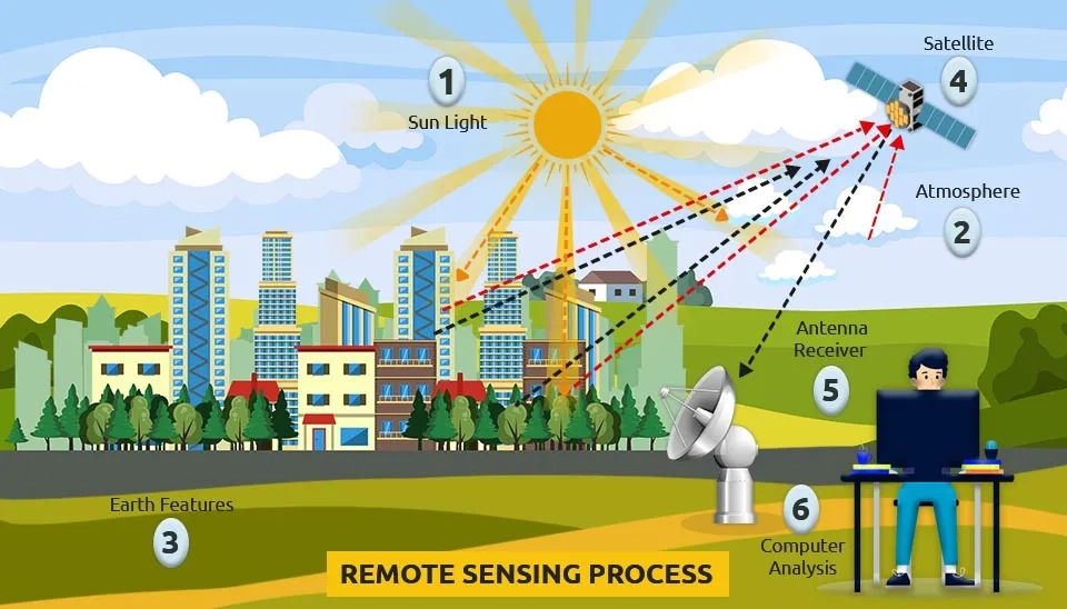
Remote sensing is the process of acquiring data/information about objects/substances not in direct contact with the sensor, by gathering its inputs using electromagnetic radiation or acoustical waves that emanate from the targets of interest. This is done by sensing and recording reflected or emitted energy and processing, analyzing, and applying that information. Interactions between incident radiation and the target of interest are also part of the process in different types of remote sensing. Remote sensing is used in data processing and analysis in more than 100 applications.
To identify and classify objects according to their class, type, substance, and spatial distribution, remote sensing is the detection and measurement of electromagnetic energy coming or reflecting from distant objects made of various materials. Remote sensing applications, unlike in situ field measurement, allow for the analysis of water quality parameters on a large scale and therefore do not limit themselves to one place or time.
There are probably hundreds of applications - these are typical: Meteorology, Oceanography, Glaciology, Topography and cartography, water management, Agriculture, Hydrology, Disaster warning and assessment, Planning applications, Oil and mineral exploration, Infrastructure, Urban, Climate, Sea, etc.
Remote Sensing Systems Comparison
1. Remote Sensing Systems
In the case of decision-making, remote sensing technology is used as an efficient and effective method. In order to improve water resource monitoring and conservation, as well as evaluate changes in environmental conditions on a worldwide scale, these informative and visual analytical tools have been widely used. The parameters for land use and land cover are closely linked to water quality. Therefore, in order to produce reliable and efficient maps of land use and land cover quickly and economically, remote sensing technology and different types of remote sensing are used. The use of remote sensing technology in monitoring and managing water quality has been carried out in different studies and a number of water quality parameters have been monitored. In addition to TDS or salinity, SS, chlorophyll-a concentration, turbidity, surface temperature, cations, and anions are some of these parameters (Gholizadeh et al., 2016; Usali & Ismail, 2010; Allan et al.,2015).
2. Types of Remote Sensing
Generally, On the basis of the source of energy used by the sensors, remote sensing can be classified into: Passive Remote Sensing and Active Remote Sensing. This is further divided into the following:
2.1. Visual Remote Sensing
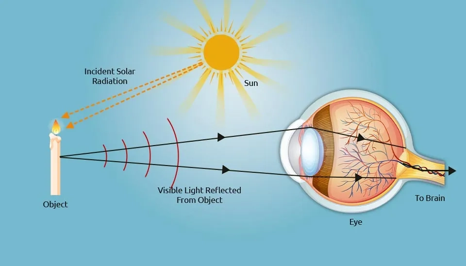
In the general sense, the human visual system is an example of a remote sensing system. As the objects/events being observed are located far away from the eyes, the information needs a carrier to travel from the object to the eyes. The visible light, a part of the electromagnetic spectrum, is the information carrier in this case. The objects are reflecting the ambient light and scattering it over them. The eyes intercept part of the scattered light, creating an image on the retina when it passes through the eye's optical system. The signals generated at the retina are carried via the nerve fibers to the brain, the central processing unit of the visual system. With the assistance of prior experiences, these signals are being decoded and interpreted in the brain. An example of "Passive Remote Sensing" is the visual system, which relies on an energy source from outside to operate. This system won't work in darkness (Ali, 2010).
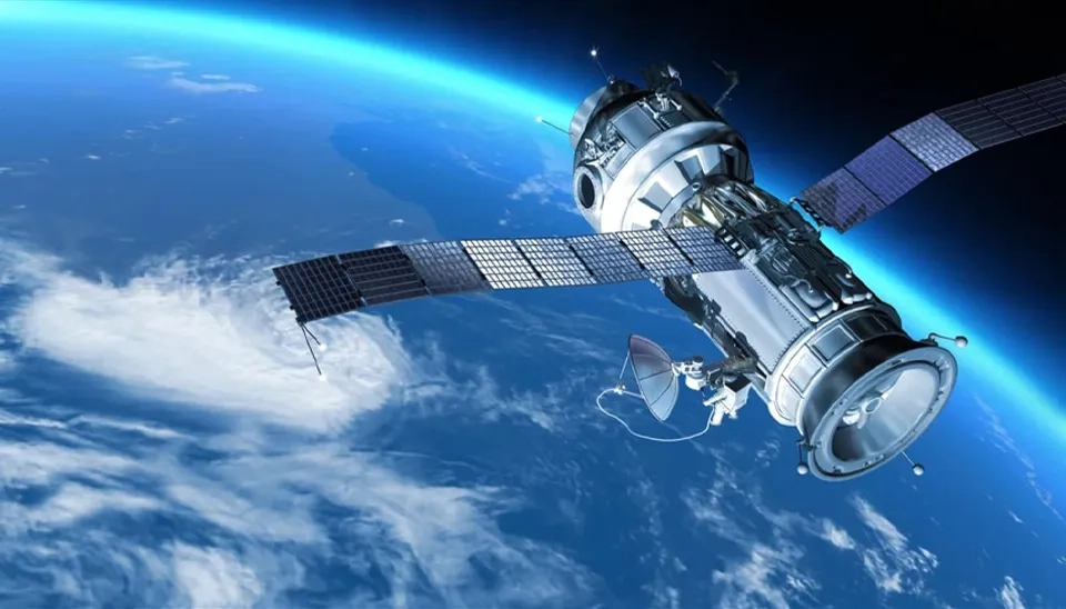
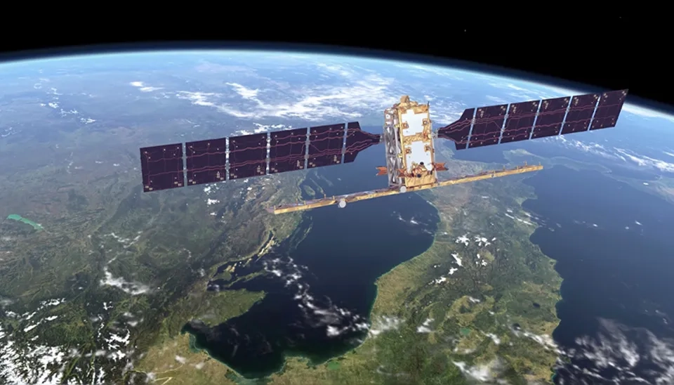
2.2. Satellite Remote Sensing
Satellite remote sensing is defined as the techniques for obtaining information on Earth's surface through special sensors mounted on satellites. Each type of earth surface feature such as soils, rocks, vegetation, and water bodies, absorbs and reflects solar radiation in a characteristic manner. It also emits electromagnetic radiation at different degrees according to the temperature. These characteristics allow distinguishing between earth features by detecting electromagnetic radiation reflected and/or emitted from the surface of the earth (Shimizu, 2019). Satellite-based sensors are now capable of making direct and indirect measurements of nearly all components of the hydrological cycle (Lettenmaier et al., 2015; McCabe et al., 2017; Y. Zhang et al., 2016). These include precipitation, evaporation, lake and river levels, surface water, soil moisture, snow, and total water storage (surface and subsurface water). In particular, evaporation and transpiration analysis via remote sensing enables researchers to quantify water loss at large spatial scales with improved temporal frequency, supporting efficient water resource management and climate studies. To support the management of water and to monitor the evolution of hazards and their effects, these sensors are capable of providing critical information (van Dijk & Renzullo, 2011).
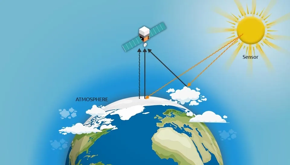
2.2.1 Optical Remote Sensing
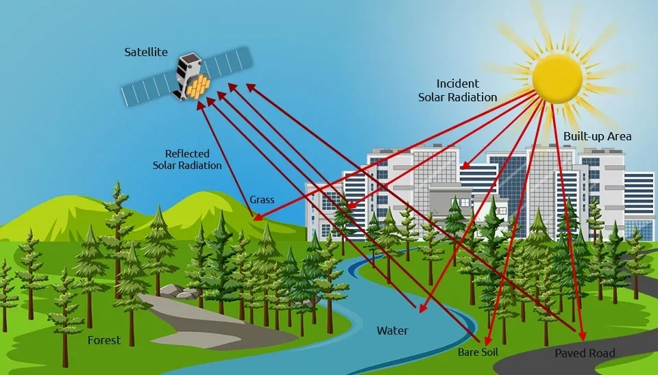
Optical remote sensing is mainly passive sensors that use the sun's energy. The USGS Landsat, NASA’s MODIS, and the ESA’s Sentinel-2 are some optical remote sensors that have been used by several researchers including water researchers for monitoring and managing water resources (Herndon et al., 2023). The wavelength region is typically extended from the Visible and Near Infrared (VNIR) to the ShortWave InfraRed (SWIR). The visible and infrared light is reflected in different ways by different materials such as water, soil, vegetation, buildings, and roads. When seen in the sun, they have different colors and brightness.
To interpret optical images, it is necessary to understand the spectral signature of different materials reflecting natural and man-made light on Earth's surface. The parameters that probably have an influence on the visual characteristics measured by remote sensing include Suspended Particulate Matter (SPM) or sediment concentrations, CDOM, turbidity, and chlorophyll-a concentrations. Non-optically active parameters on the other hand include TP, TN, COD, DO, and TDS (Guo et al., 2021; Ávila et al., 2022).
2.2.2 Infrared Remote Sensing
Infrared remote sensing uses infrared sensors to detect infrared radiation coming from Earth's surface. All objects above 0 K (absolute zero) emit electromagnetic radiation, but the radiant flux density (i.e., rate of energy flow per unit area) and spectral composition of these emissions depend on the temperature of the emitting object. The radiant flux density of an object is directly proportional to the fourth power of the object’s surface temperature , meaning that the hotter the object, the more energy it radiates, and that is true for all wavelengths of emission, according to the Stefan–Boltzmann law. The maximum wavelength of the spectral radiation emission also shortens as temperature increases according to Wien's displacement law (Blackett, 2017).
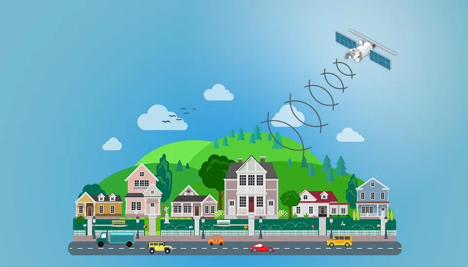
2.2.3 Microwave Remote Sensing
Several remote sensing satellites use passive or active microwave sensors. Passive sensors include Radiometers whereas active sensors include Imaging Radar. Microwave Radiometer measures the naturally emitted radiation, the brightness temperature of substances that are within its bandwidth, and the antenna's field of view. The Imaging Radar can be imagined as a camera that provides its own light to beam into the area but at radio wavelengths. Radar uses an antenna and digital computers to make pictures, rather than relying on a camera lens. Microwaves were chosen for remote sensing applications due to their numerous advantages. In daytime and night, this part of the spectrum is unique for its ability to sense objects from a distance. These waves can go through the clouds, penetrating and getting pictures in any weather. In addition to being able to transmit through water, it can also penetrate the vegetation canopy which is helpful in studying surface waters or flood extent (Rastogi, 2020).
In various applications, microwave sensors have been used in an efficient way for monitoring and solving environmental issues. They are used to study crops, forest cover, snow ice, soil moisture, hydrological processes such as floods and rainfall measurements, surface water pollution, and surface temperature detection of anomalies among others (Engman, 1998; Varotsos & Krapivin, 2020).
2.2.4 Radar Remote Sensing
Radar works by sending radio signals, and then waiting for them to bounce off the ground and come back. The main distinctive features of new generation radar satellites are their spatial resolution (to 1 m), the ability to shoot with different polarization, detection of changes to the land surface with the highest accuracy, and independence of shooting of cloudiness (Moldamurat et al., 2017). The ability to penetrate thick clouds and moisture is also an important advantage of radar.
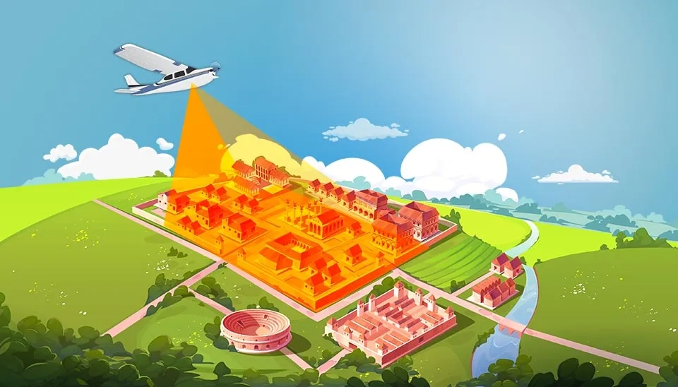
2.3. Airborne Remote Sensing
For airborne remote sensing, the aircraft is fitted with sensors that provide images of the ground surface in both downward or sideward orientation. The capability to provide very high spatial resolution images of 20 cm or less is an advantage for airborne remote sensing as opposed to satellite remote sensing. Besides, low coverage areas and high costs per unit area of ground cover are the disadvantages. Using airborne remote sensing technology is not cost-effective for the mapping of a wide area (Asanarimam, 2018).
The airborne sensors have higher spectral and spatial resolution, which makes them suitable for measuring water quality parameters. The airborne sensors are capable of operating at high altitudes covering a larger geographical area, making them suitable for regional monitoring of water quality.
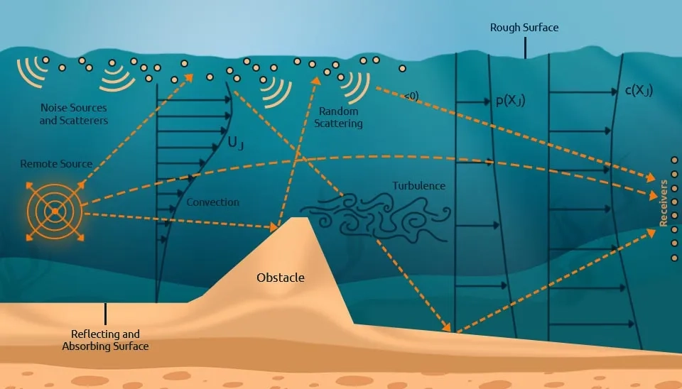
2.4. Acoustic Remote Sensing
In a general acoustic remote sensing scenario, the signal from the sound source passes through the environment to one or more receivers, where it is recorded for subsequent processing to extract information on the source or the environment. In general, the signal could be any type of sound, even random noise; the acoustic environment might be known or unknown; and the acoustic propagation might include reflection, refraction, diffraction, and scattering. Acoustic remote sensing is used in several applications such as biomedical ultrasound imaging, nondestructive evaluation, active sonar (sound navigation and ranging), oil and gas exploration, military systems, and Nuclear Test Ban Treaty (NTBT) monitoring (Dowling & Sabra, 2015).
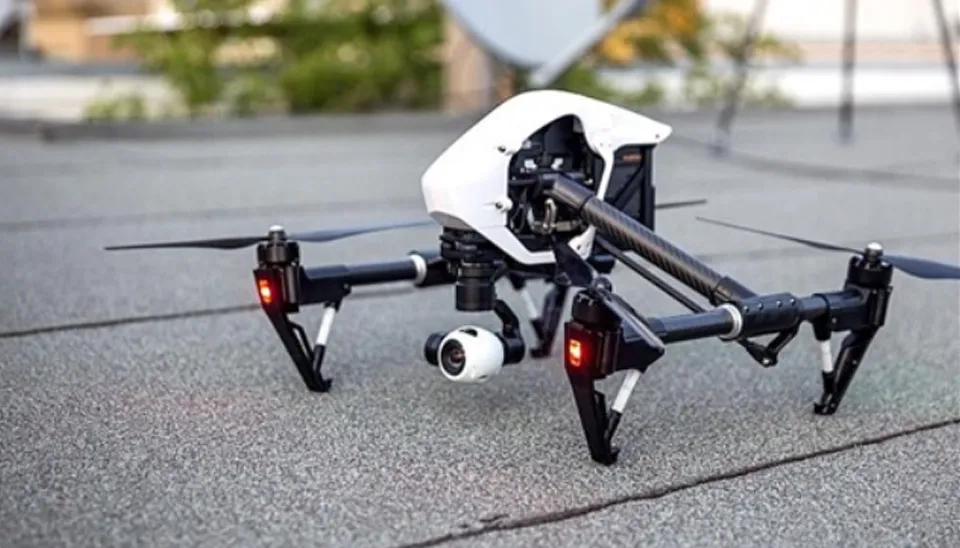
2.5. Drone-Based Remote Sensing
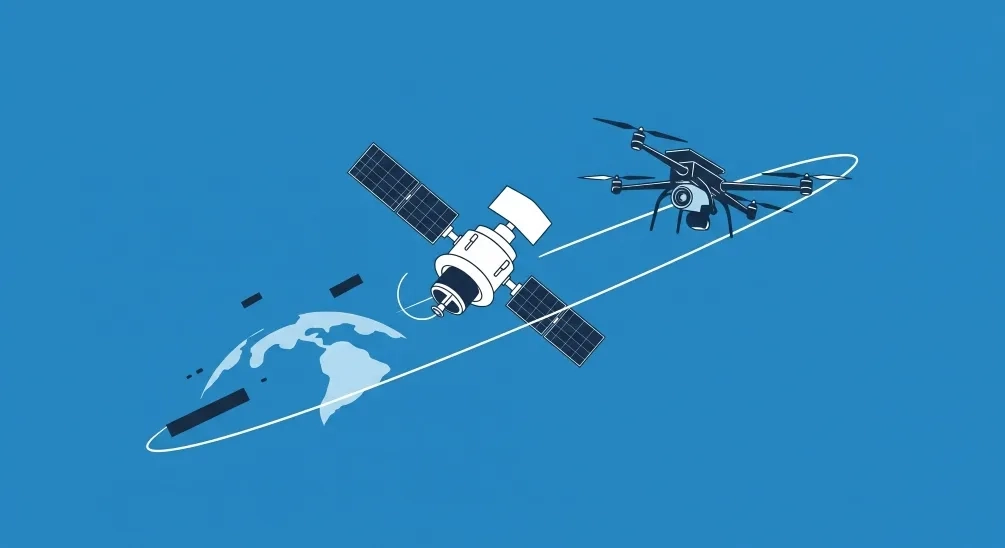
The application of the technical achievements in remote sensing studies could be greatly helped by new advances in High-Resolution Satellites with a larger number of Wavebands and constellation satellites and drone systems (Weiss et al., 2020). Drones represent new kinds of remote sensing platforms that are not expensive, easy to use, and provide users with several new options regarding where, when, and how geospatial imagery and data are collected (Noor et al., 2018). Drone-based remote sensing would allow low-cost, high spatial resolution, and flexible observations of crops and soils (Zhang and Kovacs, 2012). For drone-based remote sensing, several commercial hyperspectral and multispectral sensors are available. For the timely and effective urban planning and monitoring of crops, water stress, soil fertility, weeds, diseases, etc., drone-based remote sensing would be useful (Inoue and Yokoyama, 2019).
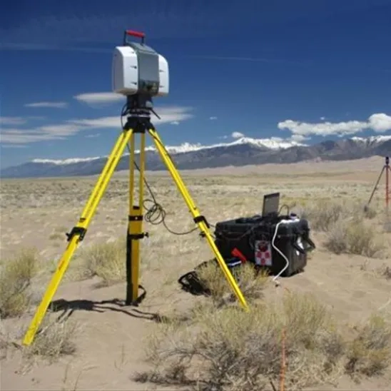
2.6. Terrestrial Laser Scanning (TLS)
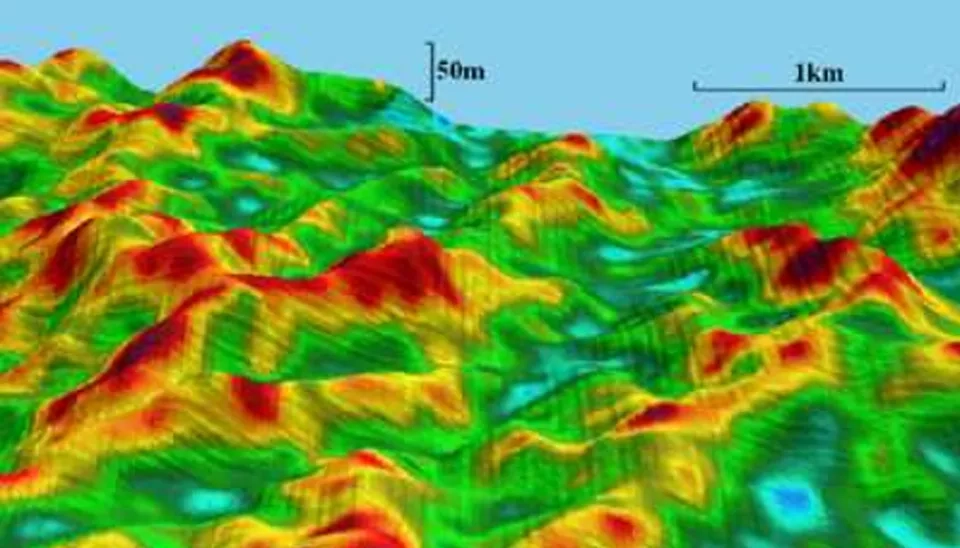
Terrestrial Laser Scanning (TLS) enables the accurate and cost-effective representation of the topographical features observed on the earth's surface, which can currently be used in geological surveys, engineering practices, cultural heritage, and mobile mapping (Wosselman & Maas, 2010). In addition to geometric data, the point cloud supplied by a TLS observation contains radiometric information, which can be used for classification purposes (Franceschi et al., 2009). TLS also has great potential to be utilized for inspection processes due to its ability to capture objects at high speed with accuracy up to sub-millimeters (Rashidi et al., 2020). The ranging system is the core component of a terrestrial laser scanner, using a laser ranger to define the distance between the scanner and an object. The principle is that by changing the deflection angle in horizontal and vertical directions, the scanner emits a laser beam to the specified scanned area. When the beam hits a reflection surface on its way, it will come back to the receiver. The distance between the scanning device and the object can be calculated using different methods of range measurement (Wu et al., 2021). TLS has gradually matured through continuous improvements and has a wide range of applications, including Architecture, Engineering, the Construction industry, structure monitoring (including change detection and deformation monitoring), civil engineering, etc.
2.7. Gamma-Ray Remote Sensing
Airborne gamma-ray spectrometry is essentially a remote sensing technique since short-wavelength bands of the electromagnetic spectrum are measured by detectors and the information is presented as images. It differs from other traditional forms of remote sensing, such as optical and thermal remote sensing, in that point measurements are collected along closely spaced flight lines and the data are interpolated to create images with a regular cell size. One of the most powerful and under-utilized methods for remote sensing of soils and regolith, particularly in vegetated areas, is airborne gamma-ray spectrometry (Bierwirth & Brodie, 2008).
3. Conclusion
Today, remote sensing is used in various applications, such as agriculture, civil engineering, urban planning, and water resource management. According to the types of remote sensing discussed in this paper, visual remote sensing, optical remote sensing, microwave remote sensing, satellite remote sensing, and airborne remote sensing are some of the most efficient and suitable types for water and wastewater management and water quality measurement. Water resources researchers, scientists, and decision-makers can rely on remotely sensed data to improve their abilities in the effective and efficient monitoring of fast-depleting water resources. Remote sensing is a useful tool for forecasting, mitigating, or even preventing future water quality issues.